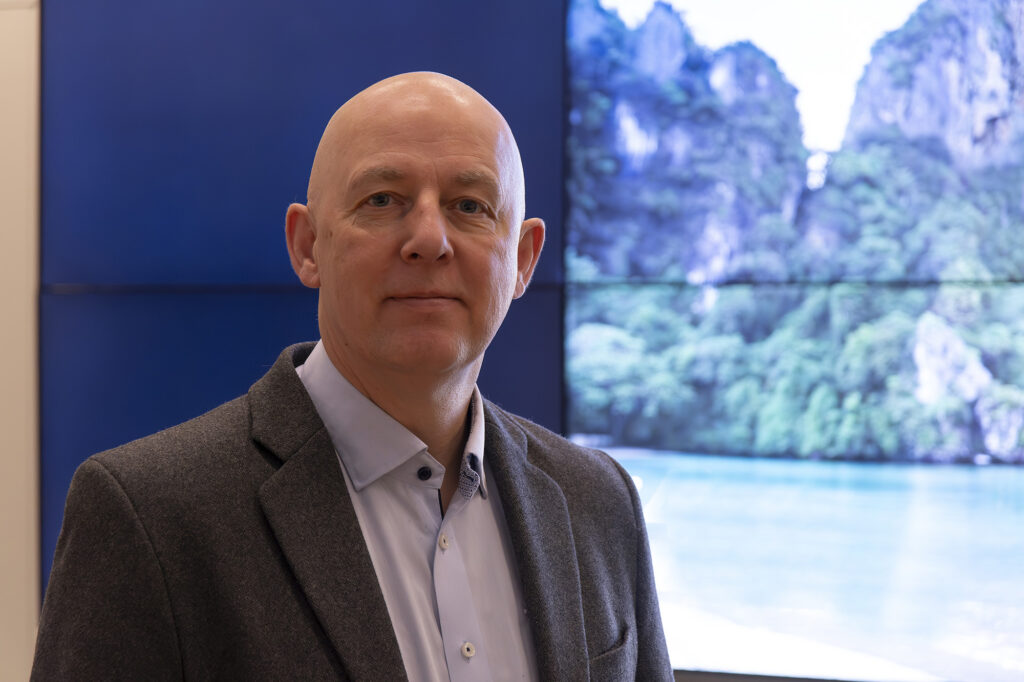
He has been working at ALOMAR almost as long as the building itself, and drives up and down the mountain to the observatory every day. Some even call him Mr. ALOMAR, meet Reidar Lyngra.

It’s Monday, and Reidar Lyngra gets in the car in Oksebåsen. He is going up to the ALOMAR Observatory. The characteristic octagonal building located at the top of the mountain Ramnan in Andøya, where he works as Technical Manager for Ground-Based Instruments at Andøya Space.
Reidar has worked at ALOMAR since 1996, almost as long as the building itself. and drives up and down the mountain every day.
If you are familiar with the weather and climate on Andøya, you probably know that it is not always suitable weather for going to the mountains, but it is rare that the weather is so bad that he cannot drive up.
“There have been a few trips where we have had to walk up, but there are not many. This is mostly thanks to the ploughing that is done in winter when it can be challenging driving conditions,” says Reidar. “If the weather does not allow it, we work from the headquarter in Oksebåsen.”
Panoramic view at work
ALOMAR stands for Arctic Lidar Observatory for Middle Atmosphere Research, an abbreviation that has been so widely used that it almost has become a proper name. The observatory is operated by Andøya Space and was founded through an international collaboration between Norway and Germany. Today, researchers from Norway, Germany, Spain and the United States monitor and map processes in the atmosphere from ground level up to 100 km.
Reidar is one of four who have a permanent workplace at ALOMAR. There, he makes sure that all the instruments work as they should and is responsible for, among other things, operation, some maintenance of various instruments and reporting to the institutes who owns the instruments. In addition, he is responsible for some radars and instruments that are placed in Oksebåsen, at Andenes and at Saura.
“A typical working day at the start of the week often involves checking the building and the instruments after the weekend,” says Reidar. “If there has been a lot of wind, it happens that some of the instruments needs some adjustments.”

Up on the roof, Reidar checks that all the instruments are in place. On this day there is almost no wind, which is pretty unusual, and none of the instruments need adjustment.
Important information about the atmosphere
From the top roof of ALOMAR, the view is panoramic, and Reidar is one of the first to see the sun when it becomes visible again at the beginning of January.
ALOMAR currently houses many different instruments, such as lidar, radars, sun photometers, brewers, GUVs, riometers, radiosonde station, ceilometers and camera systems. These instruments take measurements that provide data used for important information about the atmosphere.
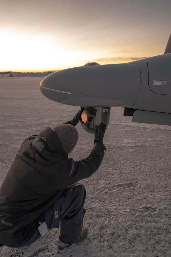
They often have researchers or employees from the institutions that own the instruments visiting. Then Reidar assists with both transport up and down the mountain, and his ALOMAR expertise.
On this particular day, two employees from Group de Optica Atmosferica Universidad de Valladolid are replacing some of the instruments on the top roof of ALOMAR. These are so-called CIMEL instruments, which, among other things, measure the intensity of solar rays at different wavelengths and water vapor. Then Reidar helps where needed.
Well known light rays
“The instrument that most people probably will recognize from ALOMAR is the RMR lidar. It is the instrument that creates the two green light rays in the sky during the wintertime”, says Reidar.

If you have been to Andøya during winter and clear weather, you have probably noticed the two green light rays from the RMR lidar. The lidar is used to routinely observe the wind and temperature from 30 to 80 kilometers when the sky is clear. Wave activity and the dynamic state of the atmosphere are also studied, and these studies are very important for understanding the radiation and energy balance in the atmosphere and thus the development of the Earth’s climate.
Breathtaking office view
Reidar sits at his desk in his office, looking out over the mountains. There is probably no one who can deny that his view is breathtaking.

“Even though I see the same view every day, I don’t get tired of it,” says Reidar.
The two visitors from the University of Valladolid have now finished their day’s work session on the roof and have to go down to one of the ground stations in Andenes to install an instrument there. Reidar is getting ready to drive them down.
“One day I might have a full day at ALOMAR, and the next day it might be an instrument somewhere else that needs a check or maintenance. The days are rarely the same, but it’s just nice to have varied days”, Reidar concludes, before he gets in the car to drive back down from the mountain.