

Integrated Remote Sensing for the Arctic (IRSA) is an international collaboration working on developing a system for situational awareness in the Arctic. IRSA will combine data from satellites, high and medium altitude long endurance drones, autonomous sea vessels and more.
– Andøya Space is a part of IRSA together with the companies C-Core in Canada, My Defence System Integration in Denmark and Boeing in the US, says Tony Klæboe at Andøya Space Defence.
IRSA’s long-term goal is to offer services for monitoring various types of human activities and environmental factors in the northern regions, to civilian as well as military customers.
– Both public and private actors want a clearer situational image of what is going on in the Arctic, not only concerning human activities such as air and ship traffic, land use and development, but also environmental factors such as pollution, animal migrations, sea ice extent, temperature measurements and more, and for search and rescue, Klæboe says.
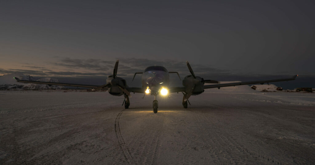
Andøya Space’s aircraft for research and testing
For testing methods and procedures for IRSA, Andøya Space Defense runs the ArcticX exercises.
– Here we use Andøya Space’s own aircraft, a Diamond DA62 MPP twin-engine propeller aircraft especially designed for research and technology testing, says Klæboe.
Andøya Space also uses this aircraft to monitor the areas on and around the island that are closed for public access during launches and missile tests.
Andøya Space offers flights for research and technology testing with this plane to customers.
– During ArcticX, we use the aircraft to simulate a drone taking pictures from the air. We practice on, among other things, outlining missions for the drone before take-off and giving it new tasks mid-flight based on satellite images of places and situations we want to take a closer look at, Klæboe says.
Combining satellite monitoring with planes and drones
Satellites can monitor large and remote areas quickly and frequently and are thus well suited for obtaining a good overview fast.
– Airplanes and drones monitor smaller areas but can examine them more closely. Thus, we practice combining the use of satellite data with surveillance from aircraft and drones, says Klæboe.

During ArcticX Andøya Space Defense has tested, among other things, how quickly the aircraft can get on its wings and find ships that satellite data show have switched off their AIS system.
The AIS signals reveals a ship’s identity, position, direction and speed, and all ships above 300 gross tons are required to carry this system.
– Depending on the distance to the ship, the weather and other conditions, we can have the plane in the air in just a few hours, Klæboe says.
A fruitful collaboration for the future
In 2024 Andøya Space Defence will run ArcticX from the 17th to the 20th June.
– We’re doing the exercise in the summer because that’s the time of year when we have the most daylight and the best weather, says Klæboe.

In 2024 the exercise will include subsea vessels to test monitoring of, among other things, underwater pipe lines and cables.
– IRSA is a fruitful collaboration for Andøya Space and has great potential to lead to services that will be very beneficial to offer our customers, Klæboe concludes.
More information
Contact Andøya Space for further information and inquiries about our defence-related services.